PublicBuddy
PublicBuddy™ is a secured cloud-based Software as a Service (SaaS) solution for mobile field data collection and its information analytics. PublicBuddy™ solution can be used in many industries as its information can be dynamically configured as per the industrys user applications.
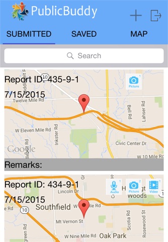
Field mobile users can capture any activity data through PublicBuddy™ Mobile App encompassing multiple pictures, video clips, audio notes, digital forms, GPS Location, and date-time information. All captured information can be immediately accessed by authorized personnel through the web-based Map Viewer application in real-time.
The PublicBuddy™ solution does not require any third-party software license and it has the following technology components:
1) Mobile App for iOS and Android Operating Platforms
2) Web-based Administration Dashboard
3) Web-based Map Viewer
PublicBuddy™ provides a real-time reporting solution for yielding analytical and geospatial intelligence to make informed decisions. PublicBuddy™ lets its users better manage their time and resources without the overwhelming risk of a human error. Organizations can reduce their resources and collect content-rich data from various sources which will increase their capacity significantly. It is an innovative smart solution for error prevention that brings ease of use with 24/7 usability.
Disclaimer: This application uses devices GPS and Continued use of GPS running in the background can dramatically decrease battery life.


